


Ibaraki City, Osaka Prefecture / Ibaraki Station West Exit Workshop, creating a perspective image of the town
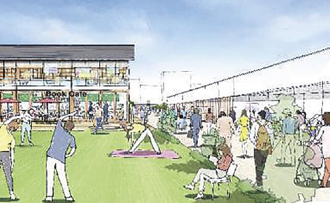
Image perspective
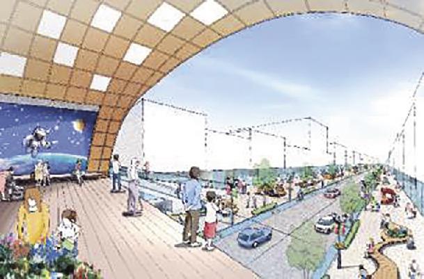
Image perspective (all from press release materials)
Ibaraki City, Osaka Prefecture held a workshop (WS) from March to September to consider future town development and usage around the west exit of JR Ibaraki Station, which is planning to redevelop, and compiled an image of town development. At the WS, we received many ideas, such as requests for a landscape that would symbolize Ibaraki, a lawn, and a station square where music events could be held. The city also created a perspective image of the city on weekdays and holidays in the morning, noon, and night. It is a policy to make use of it in the basic plan for redevelopment that will be formulated in the future.
The WS was held to consider ideas for improving the living and utilization environment of citizens and users toward the redevelopment of the area around the west exit station. A kick-off meeting was held on March 12th, and a walk around the area was held on April 23rd.
On May 21st and June 18th, ideas for community development were put forward, on July 23rd, ideas for realization were organized, and on September 4th, an image was compiled.
This fiscal year, the city entrusted R.I.A. with the task of creating a basic plan for improving the area around the west exit of JR Ibaraki Station.
The area around the station was developed in conjunction with the 1970 Japan World Exposition (Osaka Expo). Issues such as insufficient earthquake resistance and deterioration of the station square (approximately 1 hectare), roads, and the station building (2 floors below ground, 10 floors above ground, total 26,466 square meters) have surfaced.
In September 2021, the town development council, which is formed by the city and the people involved in the area around the west exit of Ibaraki Station, will formulate the "Vision for Town Development Around the West Exit of JR Ibaraki Station" based on the image of community development proposed by planning partner Taisei Corporation. . In addition to strengthening the transportation node function, a policy was set out to relocate the city's functions, which are currently arranged on a plane, in a three-dimensional and complex manner.
The target area is about 2.5 hectares from 1 to 4 in Nishiekimae-cho. In addition to "creating a hub and liveliness through public-private collaboration (station town space)", "creating relaxing and attractive spaces, introducing and updating new urban functions", "strengthening functions of public transportation and eliminating through traffic", and "vehicles" The aim is to separate and order pedestrian flow lines, make public transportation flow lines barrier-free, and improve disaster prevention.


