


The Noto Peninsula earthquake, which had a maximum seismic intensity of 7, caused severe damage mainly in Ishikawa Prefecture, as well as major tectonic movements such as ground uplift. Notable are the elevated areas, mainly in the Sotoura area of the peninsula (Sea of Japan side), and liquefaction damage occurs frequently in various areas. There are many areas in the disaster zone with completely different terrain and landscapes before and after the earthquake. As the movement towards comprehensive restoration of disaster-affected infrastructure and city reconstruction gathers pace, this article examines the future of disaster-stricken areas and the surveying industry, focusing on on the efforts of those involved in the survey field.
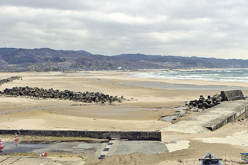
The wave dissipation block became soil due to ground lift and was buried in sand (Monzen-cho, Wajima City, photo taken March 17)
Since the disaster struck on New Year's Day, industry, government and academic officials have collected and analyzed observational data from aerial photos, satellites and sensors. different areas, and conduct field surveys to understand the extent of damage. The Japan Geospatial Information Agency analyzes data observed at electronic reference points around the epicenter area in real time, and on the day of the disaster, the electronic control point "Wajima" (Wajima City, Ishikawa Prefecture) near the epicenter moved about 1.3 meters to the west. It was announced that major crustal movements were observed mainly in Ishikawa Prefecture, including changes in the Earth's crust (preliminary data). We have continued to provide follow-up reports as we continue to analyze additional data obtained.
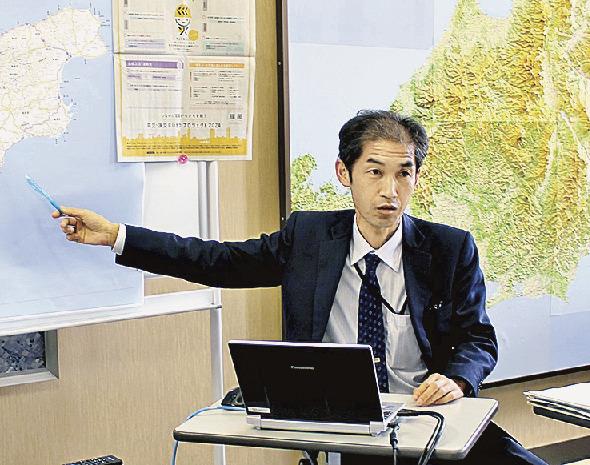
Director Shirai supports recovery and reconstruction from the survey field
Hiroki Shirai, director of the Hokuriku Area Survey Department, which serves as the hospital's front-line facility for earthquake response, returned to Toyama City, where the survey department is located, from Shizuoka Prefecture, where he was on vacation, on Monday morning, the day after the disaster. For the initial response at the scene, we first worked to establish a hotline with relevant organizations working in the disaster area, including rescue and relief units. To facilitate the transmission of information in a chaotic situation, ``we have made efforts to make people aware of the existence of our local survey department, which processes geotechnical data. management involved in a disaster situation, and building relationships and a system in which we can contact them if anything happens.” he recalls.
The Japan Geospatial Information Agency has data related to the Noto Peninsula earthquake, including crustal deformation measured with electronic reference points, seismic source fault models, magnetic images aerial, sediment/slope distribution maps, digital elevation topographic maps, three-dimensional maps, disaster state maps, and crack distribution maps are sometimes posted on a specialized website. use. You can view the latest information such as analysis results and various updated data.
The province's local response headquarters is staffed by staff from various national organizations and plays an important role as a place for information sharing. “Regardless of whether we have it or not, it is important to spread the word by getting the message out,” Director Shirai said, “We have this kind of data.” Efforts were made to expand geospatial information while receiving feedback from the field.
They actually visited about 10 of the 17 electronic reference points in Ishikawa Prefecture and investigated whether there were any problems, such as measuring slopes. We're currently working to restore items with confirmed anomalies.
In addition to the peninsula's geography, roads are cut off in many places, meaning travel time is spent checking on-site locations such as electronic waypoints, making it impossible to reach the destination in some places. In such disaster situations, collecting data from the air is extremely effective. Aerial photographs, including those taken by private companies, are said to be extremely useful in initial rescue operations, road clearing and emergency response to river channels stuck.
"Instead of providing direct support to disaster areas, such as rescuing people and restoring infrastructure, we quickly provide basic map data and aerial photography that are needed to support such activities and efforts, in confirmed areas, by revising and publishing the longitude, latitude and altitude values of reference points, which serve as location standards. (national coordinates), we support public surveys and support various construction projects for restoration and reconstruction
Shirai explains the importance of disaster response in the surveying field. We will continue to focus on disseminating useful information and data in disaster areas while tracking local needs, such as the ``Recovery Status Visualization Map lifeline'' cooperates with local authorities affected by natural disasters.
“When considering recovery and reconstruction after the Noto Peninsula earthquake, which caused extensive damage and changes,” Hidenori Shimizu, President of the Japan Association of Surveyors, said at a meeting in January. large in the crust and ground, it is important that survey experts must play an important role,” he called on those involved. We will cooperate and collaborate with the Japan Geospatial Information Agency and survey-related organizations to support the recovery and reconstruction of disaster-hit areas.
This series covers the disaster area as a joint project with the editorial board of the monthly magazine "Survey" published by Nikkan Kensetsu Kogyo Shimbun (led by Takashi Fuse, professor at the University Graduate Committee editorial advisor). Tokyo University) published. remuneration.
Invite partners to see the activities of Pacific Group Company Limited.
FanPage: https://www.facebook.com/Pacific-Group
YouTube: https://www.youtube.com/@PacificGroupCoLt


