


Taisei Construction Develops New System for Instant 3D Positioning Display – Enabling Accurate and Rapid Construction Management
October 3, 2025 – Technology & Products
Taisei Construction has developed a new system that can instantly display positioning data collected at construction sites in 3D. By integrating its in-house developed GNSS (Global Navigation Satellite System) surveying support app with 3D modeling software, the company has achieved significant improvements in both accuracy and productivity compared to conventional manual methods. This innovation enables faster and more precise construction management, and Taisei plans to conduct pilot deployments at multiple sites to further enhance the system’s functions.
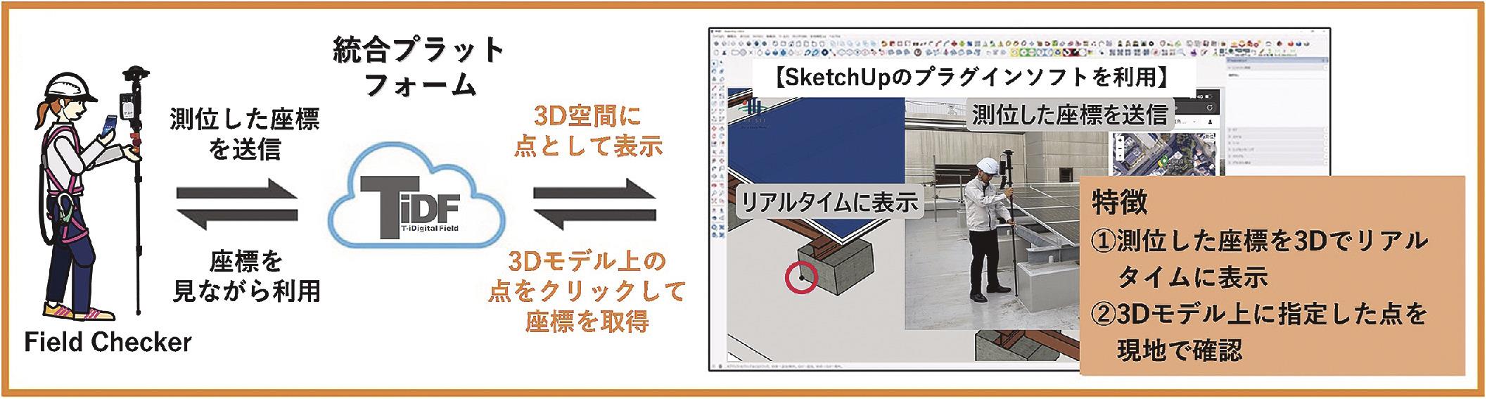
Summary of the Illustration
-
Field Checker: A GNSS-based surveying device paired with Taisei’s support app.
-
Measured coordinates are sent to the integrated platform T-iDigital Field (TiDF).
-
Coordinates are instantly displayed as points in 3D space.
-
Users can click on points in the 3D model to retrieve coordinates and confirm them at the construction site.
Key Features:
-
Displays surveyed coordinates in 3D in real time.
-
Allows on-site verification of points pre-designated in the 3D model.
The core technology is the “Field Checker” app, which works with GNSS surveying instruments and is incorporated into the company’s digital construction management platform “T-iDigital Field.” Tasks that previously required two people for simple surveying can now be handled by one, with positioning data recorded and shared in real time.
Although the platform has already been widely used within the group, previous results were limited to 2D drawings, and creating 3D models required CAD software. In addition, survey checks involved manually inputting coordinate values from drawings, which was time-consuming.
The new system links the surveying support app with the 3D modeling software SketchUp. Coordinates of designated survey points are automatically imported into the app via a cloud server, eliminating the need for manual input. Using SketchUp’s survey checking function, survey points can be confirmed instantly on a 3D model at the site, enabling accurate worker guidance.
The system is expected to be applied to civil engineering and building projects in outdoor environments where GNSS signals are available, as well as at tunnel portals and similar locations.


